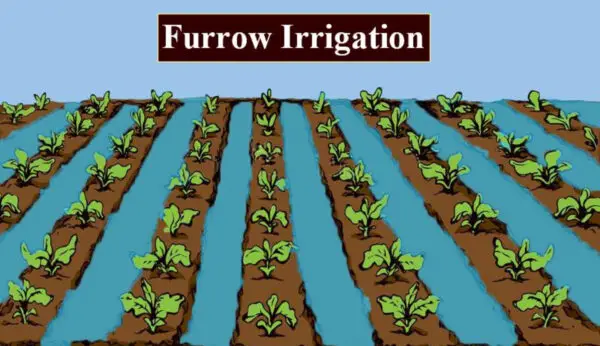
When natural rainfall falls, crops are cultivated. But what happens when there is no natural source of water? Irrigation is nothing but artificial application of water to the land or soil. Irrigation is helpful in the growing of agricultural crops, sustenance of landscapes, re-vegetation of disturbed soils in dry areas and during periods of inadequate rainfall.

But, how did this irrigation system develop in India?
The History of Irrigation practice in India can be tracked back to prehistoric times. The earliest reference to Irrigation Practices in India were noted by the ancient sage, Narada. He came to see the Emperor Yudhishthhira around 3150 B.C and asked some straight-forward questions :
“Are the farmers tough and prosperous?” “Are the dams full of water?” “Are the dams big enough?’ “Is the water distributed to different parts of the kingdom?”

By the above questions we can understand how Rulers and learned people are interested in the Irrigation system of India. Ancient Hindu architects were keen to construct viable projects for irrigation works. This would help the hard-working farmers with necessary water supply.
Around 300 B.C, Megasthenese also left a note on the Irrigation Systems in India during the rule of Chandra Gupta Maurya. The Greek Ambassador of Sleukos Nikator wrote that the “whole country was under irrigation“. To the credit of Chandra Gupta, rock inscriptions were found in the State of Kathiawar which say that he constructed the Sudarsan Lake between 300 B.C and 457 A.D.
The inscriptions also make a note of two major disasters that befell it. Due to one of the disasters the lake became so ugly that it looked like a sandy desert. Chola rulers of South India are also great architects in civil engineering and constructed necessary irrigation works.
History of Irrigation Development in India
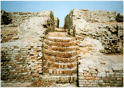
Irrigation has a long history in India, dating back to the Indus Valley Civilization (2500-1900 BCE), which had sophisticated canal systems and hydraulic structures.
The British colonial rule (1757-1947) had a significant impact on irrigation development in India. The British introduced modern engineering techniques and established irrigation departments and agencies.
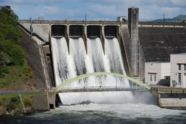
They also imposed heavy taxes on water use and land revenue, which led to the exploitation and marginalization of the farmers. Some of the major irrigation projects undertaken by the British include the Ganges Canal (1854), the Periyar Dam (1895), and the Sukkur Barrage (1932).
After independence in 1947, irrigation development became a priority for the Indian government, as part of its efforts to achieve self-sufficiency in food production and economic growth.
The government launched several Five Year Plans and schemes to expand and improve irrigation infrastructure and management.
Some of the notable irrigation projects completed after independence include the Bhakra Nangal Dam (1963), the Hirakud Dam (1957), and the Indira Gandhi Canal (1986).
Current Status of Irrigation Development in India
According to the Ministry of Water Resources, River Development and Ganga Rejuvenation, India has a total cultivable area of 195.4 million hectares, out of which 96.6 million hectares are irrigated (as of 2014-15).
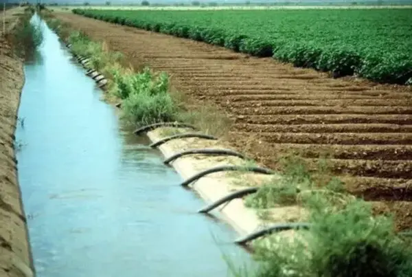
The major sources of irrigation are surface water (canals, tanks, reservoirs) and groundwater (wells, tubewells). The share of groundwater irrigation has increased significantly over the years, from 28% in 1950-51 to 62% in 2014-15.
The irrigation potential created (IPC) is the maximum area that can be irrigated by the available water resources and infrastructure.
The irrigation potential utilized (IPU) is the actual area that is irrigated by using the available water resources and infrastructure.
The gap between IPC and IPU indicates the underutilization of irrigation resources and infrastructure.
As per the latest data available from the Ministry of Water Resources, River Development and Ganga Rejuvenation, India has an IPC of 113.5 million hectares and an IPU of 93 million hectares (as of 2012-13), resulting in a gap of 20.5 million hectares.
Opportunities and Challenges for Irrigation Development in India
Irrigation development in India has many opportunities and challenges for the future. Some of them are:
Increasing water demand
- With a growing population, urbanization, industrialization, and climate change, India faces a huge challenge of meeting its water demand for various sectors, especially agriculture.
- According to a report by NITI Aayog, India is suffering from the worst water crisis in its history, with about 600 million people facing high to extreme water stress. The report also warns that by 2030, India’s water demand will be twice its supply.
Improve Water Efficiency
- One of the ways to address the water scarcity challenge is to improve water efficiency in irrigation.
- According to a study by TERI University, India’s irrigation efficiency is only about 38%, which means that only 38% of the water diverted for irrigation actually reaches the crops.
- The rest is lost due to evaporation, seepage, leakage, overuse, etc. Improving water efficiency
[Source : Irrigation and Water Power Engineering, B.C.Punmia]


